Where Have I Been? (update)
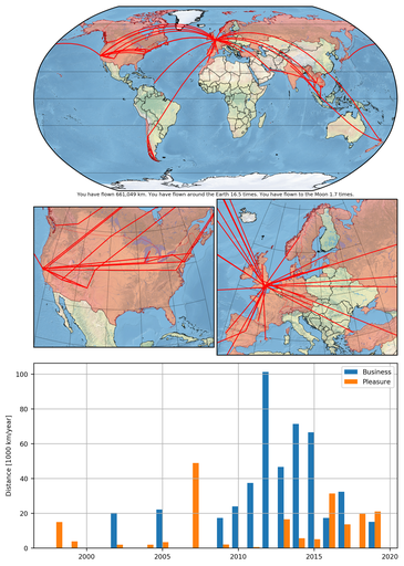
 A couple of years ago I decided to write a Python module to create flight maps (called Flight Map Creator) and I blogged about it here. Every now and then I keep on updating the CSV file and regenerating the image. I thought that it was about time that I released my new updated flight map, which is shown below.

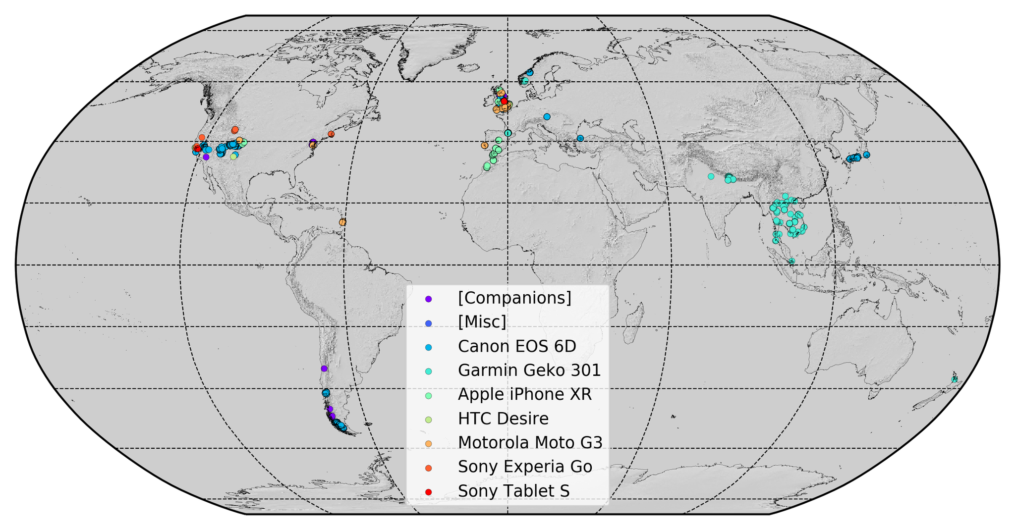
I also wrote a Python script to run my function pyguymer3.image.load_GPS_EXIF() on all my photos so that I can create a scatter plot of all of the places in the world that I have taken photos with a GPS-enabled camera. Furthermore, I added some code to load up the data that I collected many years ago (before cameras had GPS’s) using my handheld GPS (which I used whilst backpacking and hiking). This map is shown below.

As you can see, whilst the entirety of India is shaded red in the flight map I have, in fact, only been to a very small subset of the country. There are many examples of this in my travels, countries where I have only really been to one or two cities. As always, it is difficult to describe just exactly where someone has visited and therefore the above flight map is illustrative-only.