How Far Are You From National Trust Or Open Access Land?
metadata
- keywords:
- published:
- updated:
- Atom Feed
Yesterday I posted about Using Ordnance Survey Images As Backgrounds In Cartopy. My motivation for doing so was to include nice relevant background images in this post.
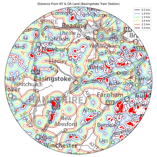
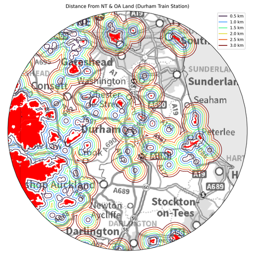
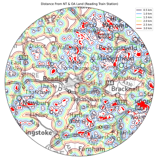
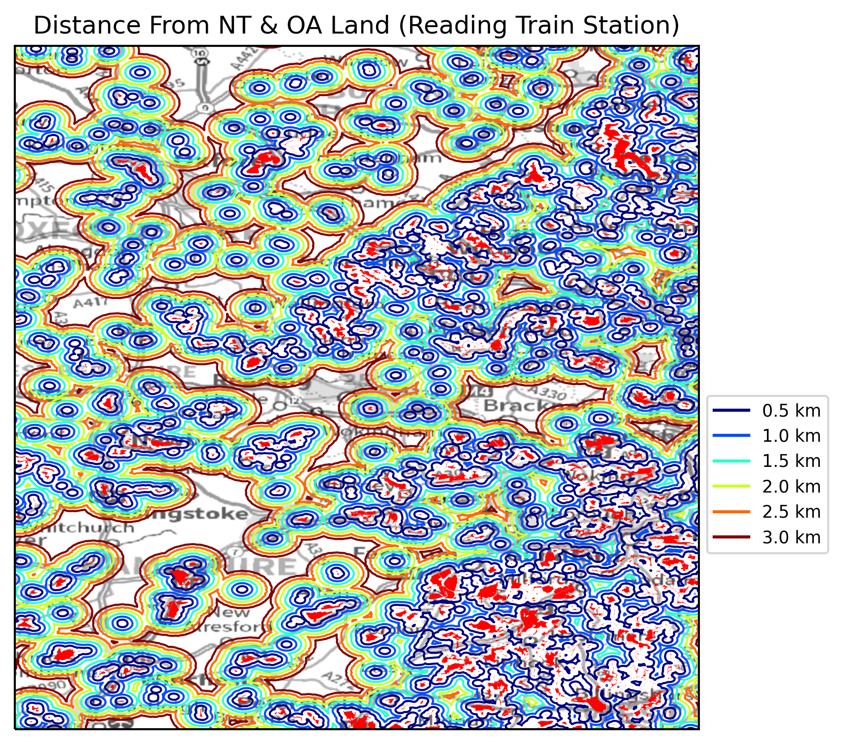
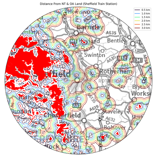
I grew up in Sheffield with The Peak District on my door step and, therefore, I often feel stifled if I live somewhere for too long that does not have good access to large bits of open land. I decided to write a Python script to plot how far a few different places are from open land. For the purposes of this post I am defining “open land” as either land that is available to National Trust members or land that is open access due to the Countryside and Rights of Way Act 2000 (CRoW Act). Conveniently, both of these categories of “open land” are available to download from ArcGIS:
For this little project I wrote How Far From Land (HFFL), which contains some Python functions and a Python script that downloads the above datasets and then buffers them (using pyguymer3.geo.bufferSrc.buffer_Polygon()) and then unites them to create as simple a shape as possible. I chose four different train stations across the country as example locations to search around and the four different plots that are made are shown below.
I think that the main message to take away here is that you are, in fact, never that far away from “open land” but that the size of the “open land” (highlighted in red in the above plots) varies greatly across the country. This leads me to conclude the above approach is too simplistic - it might be better to integrate around a point and see how much “open land” there is within, say, a 5 km radius circle. I think that might be a better way of comparing different locations in the country than simply asking how far away is a point to “open land”.